

SAFE
Advanced Landslide System
Scheda del progetto


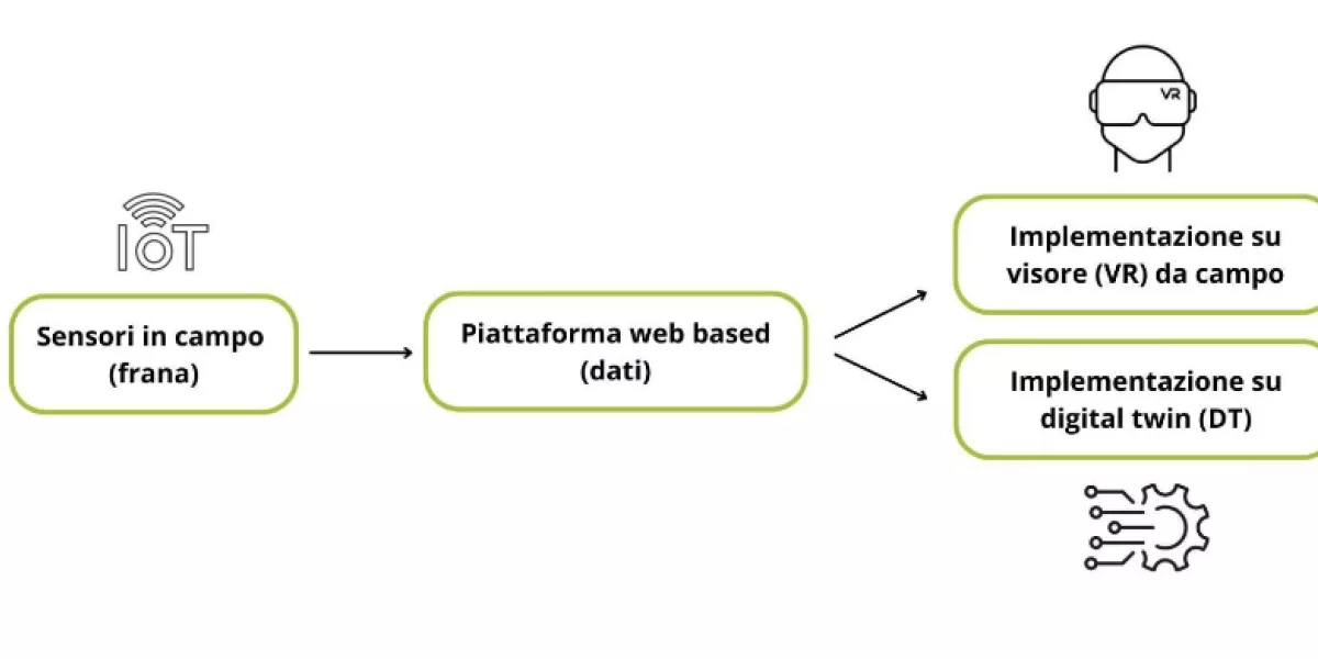
The project aims to develop an innovative methodology for monitoring gravitational phenomena in mountain areas, in particular for rapid flow phenomena. To this end, contact was made with the Municipality of Bardonecchia (TO) for the implementation of the system along the Frejus torrent basin. The intent is to obtain a functional and as economical tool as possible through the installation of a cloud of low-cost IoT sensors in the area subject to gravitational phenomena which communicates the data in real time to a web-based platform.
It envisages, on the one hand, the creation of the Digital Twin of a phenomenon of instability in a mountain area and, on the other, the possibility of viewing the data and deviations recorded by the IoT sensors installed in situ using an augmented reality viewer. This allows a significant increase in the level of safety for the operators involved in the measurement phases, as well as being able to remotely monitor the phenomenon. The collection of data from the sensors positioned in the field will be directed to a web-based platform from which the digital twin and the augmented reality viewer will continuously acquire information.
Contact:
Maximiliano Ricci
maximilianoricci@emisfera.it
3496855419
Overcoming current monitoring techniques in the field of landslide which, in some contexts, require the need to intervene promptly on the landslide body to carry out measurements. The possibility, however, of being able to remotely view on a digital model (DT) both the values recorded by the instrumentation and the real-time deformations on the three-dimensional model, allows a more informed choice of the actions to be taken both in alert phases and in emergency phases.
In addition to the technologies already in use, the use of equipment for both aerial and terrestrial data collection, the use of economically sustainable sensor networks that allow the creation of "sensor clouds" on sites at risk, but also the use of an emerging technology such as augmented reality, which will allow the operator to be aware of critical areas while maintaining a safe distance for his own safety.
The project will promote new business opportunities aimed at digital development and the possibility of carrying out low-cost monitoring in real time while maintaining very high levels of precision; the advancement of knowledge on the study of the phenomenon as well as the possibility of integrating the results obtained with various other disciplines, as well as mitigating the risk of accidents for the operators involved in the survey phases and understanding the mechanisms and processes that cause landslides and mitigating the risk; the reduction of logistical costs of personnel to be employed in the field as well as the attraction of qualified workers and/or people to mountain regions, thus combating the phenomena of brain drain and mountain depopulation; possibility of developing management and restoration strategies for affected ecosystems.